AW Aviation Consultancy Services Limited
Radar data consultants.
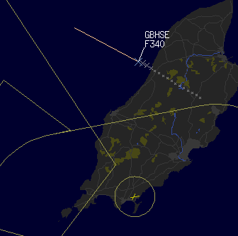
Visualizr

Visualizr is our in-house radar display / Combiner, Assignor, Windfarm mosaic function.
Tracks, Plots, Weather, Route data can be displayed.
Additional Weather data (current winds aloft) derived from tracks and aircraft behaviour is currently being designed (See news for progress).
We are in the process of adding all the Eruocontrol standard safety nets, plus a few additional designed safety nets.
Working safety nets include: STCA, MSAW, MRVA, APW, RA.
Working new safety nets: QNH-M (incorrect set QNH,QFE), , ITC (Instantaneous terrain display and TC (Terrain clearance)
Work in progess (watch news page for updates) include: CLAM (Cleared level monitor) , NTCA (Near time conflict alert).
Other features under design include Vertical View lists, 3D approach funnel depiction, utilising Wind aloft; Reduced approach separation timings, Climb/Descend monitor.
Transverse Mercator projection display
Terrain derived from DEM models can be overlaid on the current map set.
Maps derived from OS Strategi mapset (transposed to WGS84 lat/longs using Helmert transformations (7m accuracy)).
A working assignor function enables PSR radar and remote SSR radarto be dsplayed as Combined plots.
A working mosaic function allows one of the radar inputs to be used as a mosaic infill to mitigate against wind farm developments in the approach area. A second radar which is either terrain shielded or able to 'filter' wind farm clutter would be required to provide the mosaic picture.
A ground version of Visualizr with route conformance and best route calculations will be under development soon.
A 'light' version of Visualizr is available without the safety net, mosaic or assignor functions could be used in Apron control, flying schools or as a presentation device for training purposes.